
Land Surveying
We create meaningful connections, tangible and intangible, that help shape the present and prepare our clients and communities for generations to come. Our commitment to creating flourishing communities is measured by the successes we help our clients achieve, and ultimately the positive impacts we have on individuals.
Our spirited client commitment, award-winning projects and intelligent solutions create a steady stream of exciting, new client opportunities. Check out some of our recent success stories below.
The Erie Zoo
North American River Otter’s habitat @ The Erie ZooErie, Pennsylvania Otter exhibit expansion and renovation to meet updated requirements for size and habitat. CT worked closely with the Erie Zoo and the design team from Roth Marz Partnership to provide survey and...
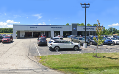
New Motors in Erie, PA
New Motors Subaru Building Service Addition Erie, Pennsylvania This 2-acre expansion is on an existing site that is partially developed with an existing building while the other half is wooded. The planned improvements include an additional asphalt parking lot,...
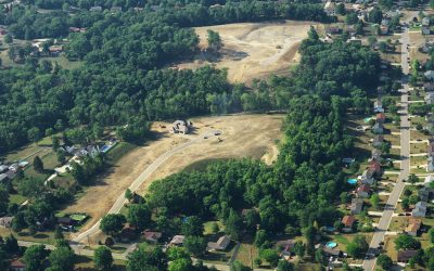
Fox Ridge Subdivision
Fox Ridge SubdivisionGreen Township, Ohio The subdivision layout protected the environmentally sensitive areas and blended with the existing topographic features of the site. The project was developed efficiently with minimal impact on the surrounding properties. The...
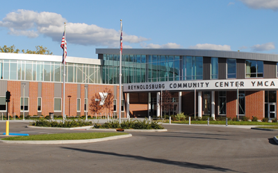
YMCA of Central Ohio – Reynoldsburg Community Center
YMCA of Central OhioReynoldsburg, Ohio The new YMCA and Community Center offers something for everyone! The City of Reynoldsburg had the opportunity to add to its legacy of a strong parks system by purchasing 11 acres adjacent to its 42-acre Huber Park property. This...
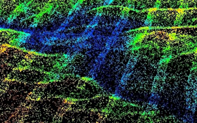
Using Geospatial for Structural Inspections
Using Geospatial for Structural InspectionsVarious Locations Drone imagery also provides necessary information for structural conditions. Our terrestrial scanning provides detailed conditions of building envelopes, collecting highly accurate data and scanning...
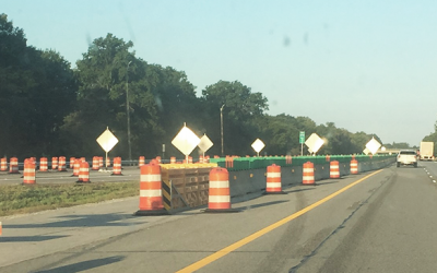
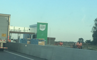
Ohio Turnpike and Infrastructure Mainline Pavement Reconstruction Projects 2013 – Ongoing
Ohio Turnpike and Infrastructure Mainline Pavement Reconstruction Projects 2013 - OngoingVarious Counties, Ohio The successful design of projects totaling $250 million in construction. Since 2013, CT has designed the reconstruction of five segments of Ohio Turnpike....
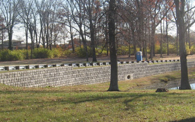
ODOT Retaining Walls
ODOT Retaining WallsVarious, Ohio Providing continued structural engineering solutions and applications to ODOT. CT has completed detailed design plans for nearly 100 retaining wall structures associated with bridge and roadway projects for the OH Department of...
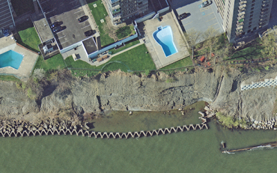
Geospatial for Erosion Inspections and Flood Management
Geospatial for Erosion Inspections and Flood ManagementVarious Locations Our aerial mapping services assist clients to gauge the impacts and levels of flooding. We inspect the impacts of shoreline erosion through our drone imagery. Shorelines, especially the...
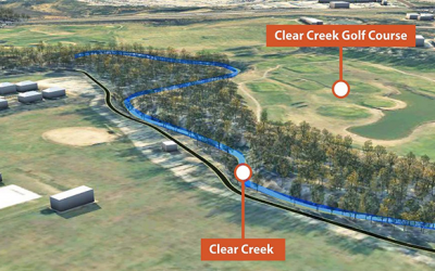
Clear Creek Floodplain Analysis and Path Design
Clear Creek Floodplain Analysis and Path DesignBatavia, Ohio The project includes the analysis of impacts to the Clear Creek FEMA floodplain with LIDAR survey surfaces, bathymetric cross-sections, and aerial photography through HEC-GEORAS and HEC-RAS software. CT...
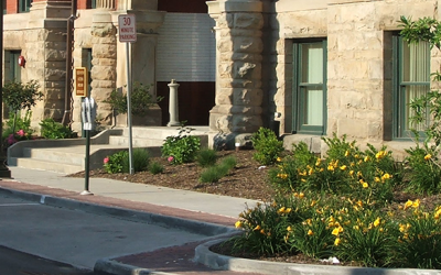
Streetscape Improvements Phases I-III
Streetscape Improvements Phases I-IIIBradford, Pennsylvania The City of Bradford retained CT to assist with a multi-phased redevelopment of the downtown area. CT helped raise funding from several sources including, the Commonwealth of Pennsylvania Redevelopment...
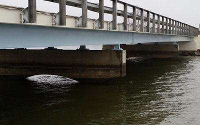
Bathymetric Survey Required for Design Improvements
Bathymetric Survey Required for Design ImprovementsTrumbull County, Ohio To support design efforts, CT provided a bathymetric survey of both sides of the causeway, including the areas around both bridge abutments and fisherman platforms. While repairs were only...
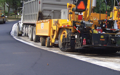
Sunbury Annual Street Improvements
Annual Street ImprovementsSunbury, Ohio Commitment to community infrastructure. As City Engineer or consultant to so many communities in the region, CT often manages the communities’ annual street program. Annual Street Maintenance Programs maintain the public streets...
Aerial Photography and Airborne LiDAR Set the Stage for Community’s Planning Needs
Aerial Photography and Airborne LiDAR Set the Stage for Community’s Planning NeedsWheeling, West Virginia CT’s geospatial team performed aerial photography and airborne LiDAR for the City of Wheeling, WV, and the surrounding area covering nearly 30 square miles....
Aerial and Mobil LiDAR Aids Design of Ohio Turnpike Improvements
Aerial and Mobil LiDAR Aids Design of Ohio Turnpike ImprovementsVarious, Ohio The single digital delivery format was AutoCAD Civil 3D to OTIC CAD Standards, meeting the four-month project schedule. This project involved mapping of 60 miles of the Ohio Turnpike for...